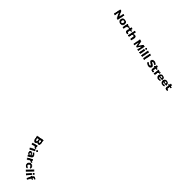
0 BRIARCLIFF LN
Owner Information
HOLLISTON, TOWN OF
703 WASHINGTON ST
HOLLISTON, MA 01746


Property Details
0 BRIARCLIFF LN is classified as a Vacant, Conservation (Municipal or County).
0 BRIARCLIFF LN is valued at $70,500. The land is valued at $70,500 and the structures are valued at $0.
This property is in Zone CL4. Confirm with local Zoning Board authorities to ensure there are no overlays or other easements on this property.
The most recent deed for 0 BRIARCLIFF LN is recorded at the local registrar in Book 18807, Page 0145. 0 BRIARCLIFF LN was last sold on Friday, January 8, 1988 for $100.
Assessment data from fiscal year 2022.
Flood Data
This property is partially within the A Zone (within floodplain). Approximately 13.29 acres (66.5%) of the property is within this zone.
This information is sourced from the FEMA National Flood Hazard Layer. See our full disclamer.
Broadband Internet Providers
| Provider | Type | Bandwidth (mbps) | |
|---|---|---|---|
| VSAT Systems, LLC. | Satellite | 2 | 1 |
| HughesNet | Satellite | 25 | 3 |
| GCI Communication Corp. | Satellite | 0 | 0 |
| Comcast | Cable | 1000 | 35 |
| Verizon New England Inc. | Fiber | 940 | 880 |
| Viasat Inc | Satellite | 100 | 3 |
Broadband service provider data from December 2020.
Adjacent Properties
- 0 STERLING RD HOPKINTN
Undevelopable Residential Land owned by CANTY, ERIC C - 0 STERLING RD HOPKINTN
Undevelopable Residential Land owned by JEFFERS, JASON L & MARISSA C - 0 STERLING RD HOPKINTN
Undevelopable Residential Land owned by PATTIN, MARK & BARBARA - 0 N MILL ST
Undevelopable Residential Land owned by MARCULITIS, JOHN M - 70 BONNEY DR
Single Family Residential owned by LANGMEYER, CHRISTOPHER J - 30 BRIARCLIFF LN
Single Family Residential owned by FERKLER, SCOTT & ERICA - 38 BRIARCLIFF LN
Single Family Residential owned by GALDI, PETER A & ANGELA S - 48 BRIARCLIFF LN
Single Family Residential owned by FAISON, AUSTIN B & NNEKA N - 78 BRIARCLIFF LN
Single Family Residential owned by HOLLY, CAROL TRUSTEE OF CAROL HOLLY TR - 68 BRIARCLIFF LN
Single Family Residential owned by DEE, THOMAS J & JACQUELINE A - 100 BRIARCLIFF LN
Single Family Residential owned by COLLINS, CHRISTOPHER W & SHERYL A - 106 BRIARCLIFF LN
Single Family Residential owned by GIBSON, MOYA R & - 114 BRIARCLIFF LN
Single Family Residential owned by SHAISHAA, ABRAHAM-MAGID & - 96 N MILL ST
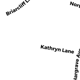
Single Family Residential owned by TATE, JEFFREY A & MICHELLE F - 35 KATHRYN LN
Apartments with Four to Eight Units owned by TSYBULSKI, OLEG & BUKHAREV, KONSTANTIN - 30 KATHRYN LN
Apartments with Four to Eight Units owned by MALONEY, PETER F - 80 BONNEY DR
Single Family Residential owned by DEJESUS, ADRIANA B